Guide No. 27 · The Castle Rolls
Scottish Border Castles and the Debatable Land
Seventy miles of hill country between the Solway and the Tweed carried more sieges than anywhere else in Britain. It also carried a strip of ground that neither kingdom would govern, and would not let the other have.
A border castle is one built or held to control the frontier between England and Scotland, running roughly from the Solway Firth in the west to the mouth of the Tweed in the east. What makes these castles a group rather than a scatter is that the line was a military frontier for some four hundred years, not a settled boundary: the crowns garrisoned them, granted them to families who would fight for them, took them back by forfeiture, and lost and retook them with each war. Near the western end lay the Debatable Land, a strip of about ten miles by four between the Esk and the Sark that both kingdoms claimed and neither policed, until it was partitioned by agreement in 1552.
A line that took four centuries to settle
The border was drawn on paper long before it was quiet. The Treaty of York in 1237 had Alexander II give up the Scottish claim to Northumberland, Cumberland and Westmorland, which fixed the boundary roughly where it still runs. What it did not fix was who held the ground, and from the outbreak of the wars of independence in the 1290s the frontier became a place where castles were the currency of the argument.
Berwick shows the pattern at its most extreme. The richest Scottish trading port of the thirteenth century, it passed between the two kingdoms about thirteen times between 1147 and 1482, when the English took it for the last time. Roxburgh shows the other end of the same story: one of the four royal castles the Scots crown could not do without, held by English garrisons for most of the fourteenth and fifteenth centuries, and finally demolished by the Scots themselves in 1460 so that nobody could hold it against them again. James II had been killed beneath its walls days earlier when one of his own siege guns burst.
The chain, west to east
Carlisle anchored the western end. Begun under William Rufus in 1092 on ground the Scots had held, it is one of the most besieged places in Britain and is still roofed, which is unusual for a castle this far north on this line. Mary, Queen of Scots was lodged there in 1568 after fleeing into England, and in 1596 the Scottish warden's men broke into it to rescue Kinmont Willie Armstrong, an episode that came close to starting a war on its own.
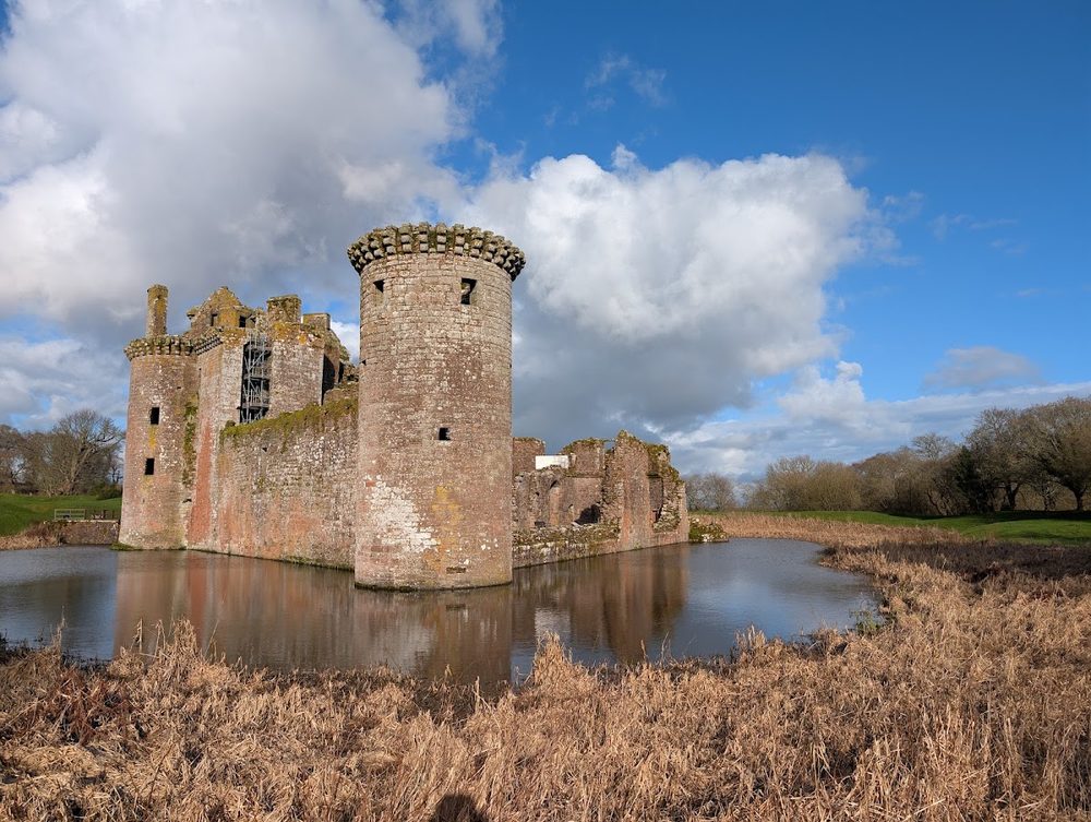
Facing it across the frontier were the western Scottish castles. Caerlaverock guarded the Solway approaches from behind a double moat, and Edward I's siege of it in 1300 was recorded in a heraldic poem, the Roll of Caerlaverock, which names the lords who turned up. Lochmaben sat in Annandale in Bruce country and spent long stretches of the fourteenth century under English garrison until Archibald the Grim took it back in 1384. Archibald's own castle at Threave, on its island in the Dee, was less a border fortress than the seat of the family who ran the western march for the crown, until James II besieged it in 1455 and broke the Black Douglases for good.
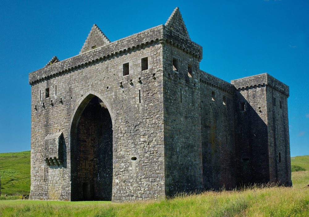
In the middle sat Hermitage, alone in Liddesdale, guarding the worst of the raiding country. Its keepers held the office of Warden of the Middle March or Keeper of Liddesdale, and its history is correspondingly grim. In October 1566 Mary, Queen of Scots rode roughly twenty-five miles from Jedburgh to visit the wounded Earl of Bothwell there, and the fever she developed on the way back nearly killed her.
The eastern end was Tweed country, and the Tweed crossings were what mattered. Norham was built for the bishops of Durham from about 1121 above one of them, and was attacked so regularly that its garrison list reads like a chronicle of the wars; James IV took it in 1513 shortly before the two armies met at Flodden. He took Etal on the same campaign. Behind the line, the Percy castles at Alnwick and Warkworth held the English north together, and Alnwick had already made its mark on the frontier in 1174, when William the Lion of Scotland was captured outside it and had to hand over four royal castles to get home.
The Debatable Land
Between the Esk and the Sark, north of Carlisle, lay ground that belonged to nobody by agreement. Both crowns claimed the Debatable Land and neither would let the other take it, so for generations the compromise was that it stayed ungoverned. Grazing by day was tolerated; permanent building was not, and towers went up there anyway and were burnt for it.
That suited the riding families very well, and the Armstrongs and Grahams made it their own. It is the ground behind the story of Johnnie Armstrong of Gilnockie, hanged with his followers by James V in 1530 on a royal expedition intended to show that the crown's writ reached this far. It plainly did not reach far enough, because in 1551 the two governments gave up on policing the strip altogether and declared, in effect, that anyone living there could be robbed, burnt out or killed with no redress in either kingdom.
The following year they solved it properly instead. Commissioners for both crowns, with the French ambassador arbitrating so that neither side could claim a stitch-up, agreed a line across the strip on 24 September 1552. It was then dug into the ground as the Scots' Dike, an earthwork about three and a half miles long, which is still the border there today and is one of the few pieces of the whole story you can walk along rather than pay to enter.
Disarmed rather than outgrown
The frontier did not fade out; it was closed down. When James VI became James I of England in 1603 the border stopped being a boundary between two crowns, and he renamed it the Middle Shires and set about taking its teeth out. The Marches and their Wardens were abolished, the riding families were broken up, and the crown ordered places of strength on the border demolished apart from the houses of noblemen and barons. A frontier full of fortified buildings is only useful while there is a frontier.
What that leaves is a landscape of very unequal survival. Carlisle still has its roof and its garrison buildings; Berwick has ramparts good enough to be studied as a piece of military engineering; Caerlaverock, Threave and Hermitage stand as substantial ruins in state care. Roxburgh, which mattered as much as any of them, is a mound in a field. The gap between those two outcomes is not a measure of how important the castles were. It is a measure of who was still willing to spend money on them once the fighting stopped.
Quick answers
What is a border castle?
A border castle is one built or held to control the frontier between England and Scotland, roughly the line from the Solway Firth in the west to the Tweed in the east. The two crowns fortified this line heavily from the twelfth century onwards because it was a working military frontier rather than a settled boundary: castles here changed hands with the wars, were garrisoned by the crown or by families acting for it, and were designed to hold a crossing, a road or a river mouth rather than simply to house a lord.
What was the Debatable Land?
The Debatable Land was a strip of ground near the Solway Firth, roughly ten miles by four, between the rivers Esk and Sark just north of Carlisle, which neither the English nor the Scottish crown would concede to the other. Both claimed it and neither governed it, which made it a refuge for raiding families, above all the Armstrongs and Grahams. It was partitioned in 1552 after arbitration by the French ambassador, and the agreed line was marked on the ground by an earthwork called the Scots' Dike.
Which castle on the border changed hands most often?
Berwick-upon-Tweed has the strongest claim. The town and its castle passed between English and Scottish control around thirteen times between 1147 and 1482, when it was taken for England for the last time. It was the wealthiest Scottish trading port of the thirteenth century, which is a large part of why both kingdoms kept fighting over it, and the Elizabethan ramparts you can walk today were built to hold it once and for all.
Why are there so many ruined castles on the Anglo-Scottish border?
Because the frontier was fought over for roughly three centuries and then deliberately disarmed. Sieges, slighting and cross-border raids wrecked a great many border strongholds while the wars were running, and after the Union of the Crowns in 1603 James VI and I set about dismantling what was left, ordering places of strength on the border demolished apart from the houses of noblemen and barons. Roxburgh, once one of Scotland's four great royal castles, is now a grassy mound with fragments of wall.
Which border castles can you visit today?
Most of the surviving ones. Carlisle, Norham, Etal, Warkworth and Berwick's ramparts are in English Heritage care on the English side, and Hermitage, Caerlaverock and Threave are in the care of Historic Environment Scotland to the north. Alnwick and Bamburgh are privately owned and open in season. Lochmaben and Roxburgh are free ruins in open ground with no facilities, and Roxburgh in particular is a mound rather than a building.
Where to stand inside the idea
Ten castles on the roll that held, lost or fought over the Anglo-Scottish frontier:
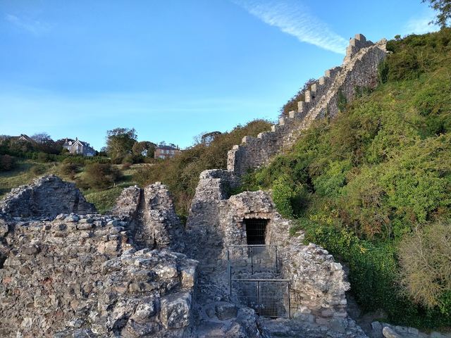
Berwick-upon-Tweed Castle and Ramparts
The prize the two kingdoms fought over hardest. Little of the medieval castle survives, but the Elizabethan ramparts round the town are among the most complete artillery defences in Europe.
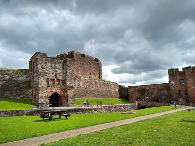
Carlisle Castle
The anchor of the English west march, begun under William Rufus in 1092 and still roofed. Mary, Queen of Scots was held here in 1568, and Kinmont Willie Armstrong was sprung from it in 1596.
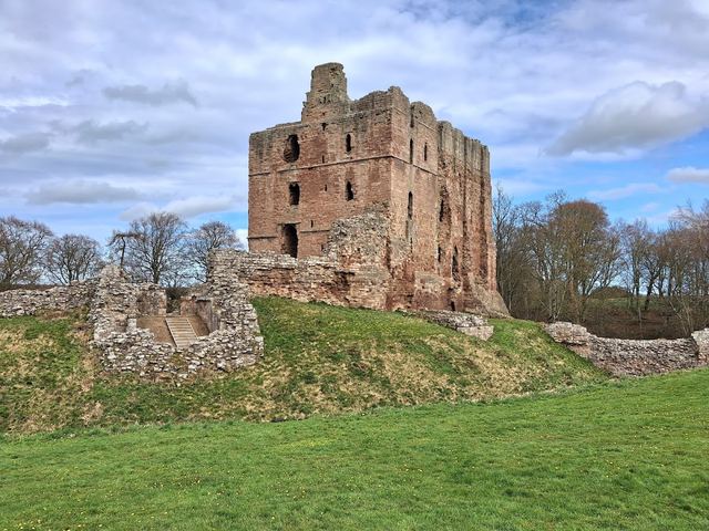
Norham Castle
The bishops of Durham's fortress above a crossing of the Tweed, begun about 1121 and besieged again and again. James IV took it in 1513, days before Flodden.
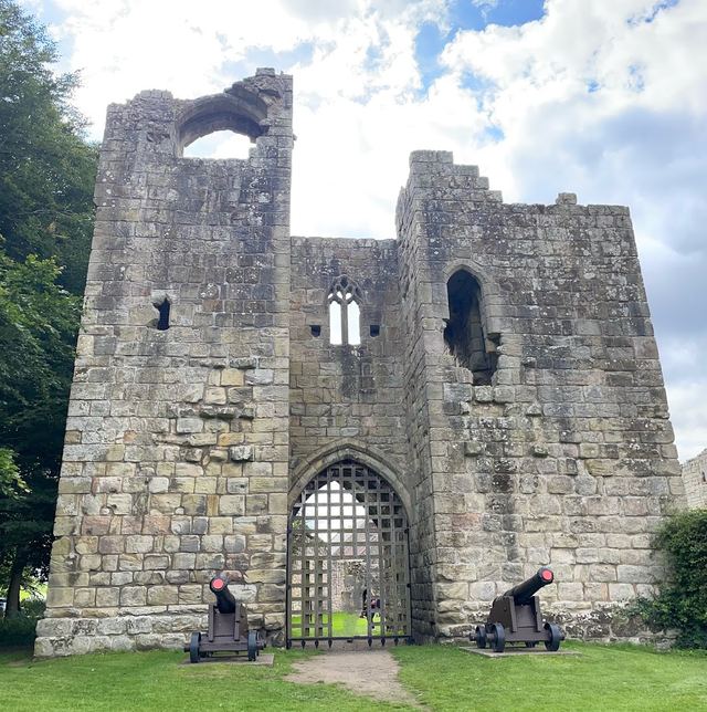
Etal Castle
A small Northumberland castle taken by James IV on the same 1513 campaign. The battle of Flodden was fought a few miles away, and the site now tells that story.
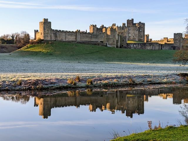
Alnwick Castle
The Percy stronghold and the head of English power in the north. William the Lion of Scotland was captured outside it in 1174, a capture that cost him four royal castles.
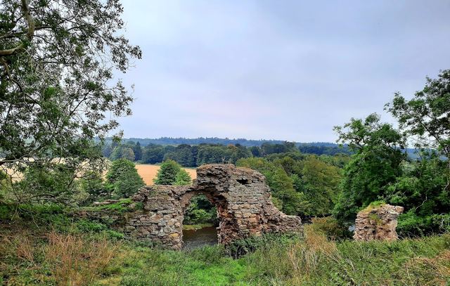
Roxburgh Castle
Once one of Scotland's greatest royal castles, held by the English for most of two centuries. James II was killed beneath it in 1460 when his own siege gun burst, and the Scots pulled it down days later.
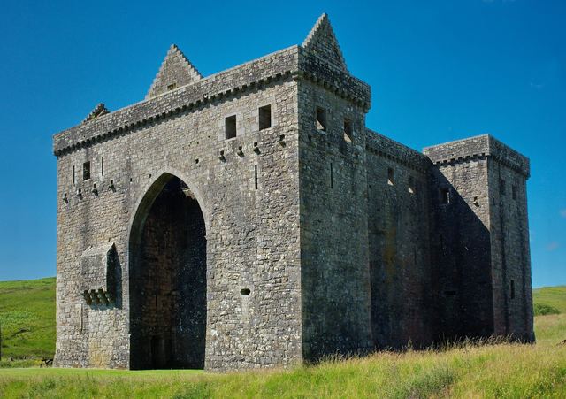
Hermitage Castle
The bleak stronghold of Liddesdale, the most lawless valley on the line. Mary, Queen of Scots rode roughly twenty-five miles from Jedburgh to reach it in 1566 and nearly died of the fever that followed.
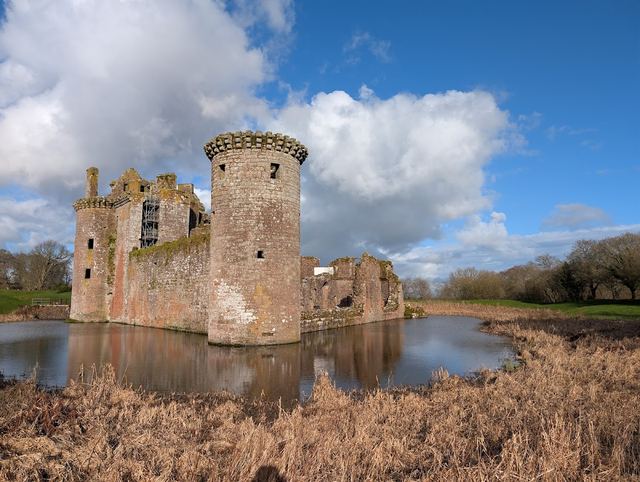
Caerlaverock Castle
A triangular moated castle guarding the Solway approaches, besieged by Edward I in 1300 in a campaign so celebrated it got its own heraldic poem, the Roll of Caerlaverock.
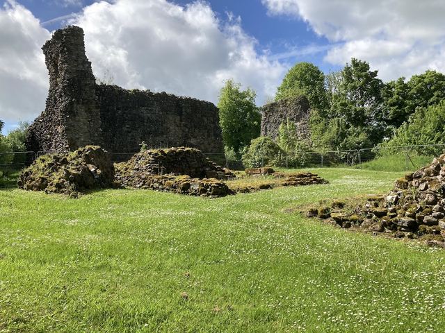
Lochmaben Castle
A lochside ruin in Annandale, in Bruce country, held by English garrisons for long stretches of the fourteenth century until Archibald the Grim took it back in 1384.
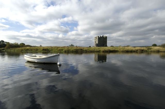
Threave Castle
Archibald the Grim's island tower in Galloway, reached by boat, and the Black Douglas power base that James II besieged in 1455 when he broke the family.